

27.01.23 - The SILVA project : Satellite-based Inspection of Large Vegetated Areas

One third of Switzerland is covered by forest. With the access to new satellite images, it becomes possible to monitor the health of the forest in near real time.
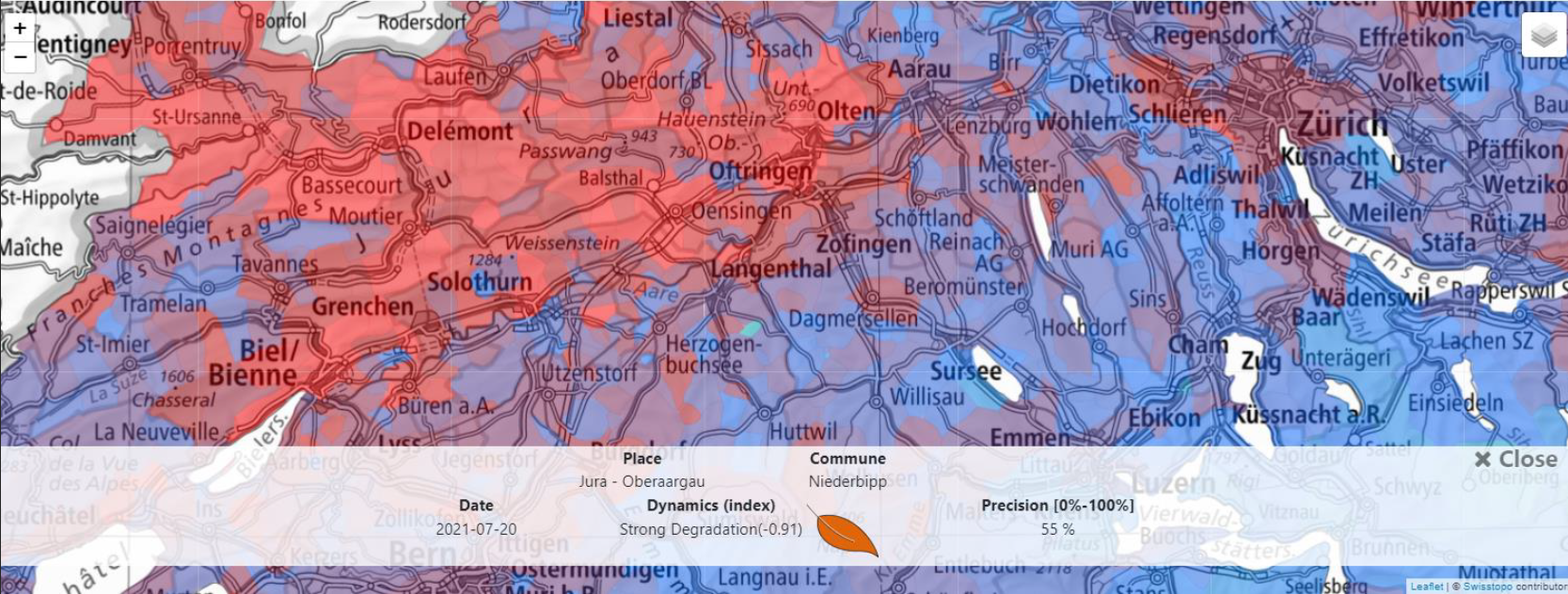
Eidg. Forschungsanstalt WSL, ETHZ and ExoLabs have carried out the SILVA project : Satellite-based Inspection of Large Vegetated Areas. A platform has been developed that provides indicators to assess the state of the forest, the Vegetation Health Index (VHI) has been used, merging data from different satellites.
The objective: a more dynamic management of forests by identifying more quickly the areas of disturbance and make automatic assessment of damage.
The use of images produced by the Sentinel 2 and 3 constellations allows the platform to have a high temporal and spatial resolution. The access to the archives also allows to make comparisons between the current state and the past, more than 20 years of archives are available.
A first version of the platform is available - ExoSilva, the challenge being as in all data science work, to compare the results with the ground truth, taken at the same time.
A good example of the potential use of satellite images for forest management, with the challenge of creating tools that can be easily used by foresters.
Geo Innovation News from Swiss Territorial Data Lab
#remotesensing #data #forest #datascience